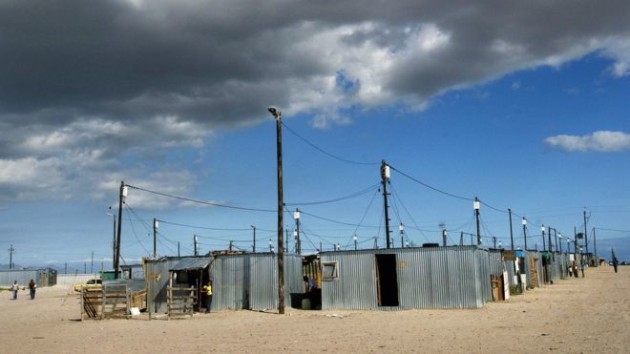
Satellite images used to predict poverty
 Paul Rincon / Aug. 19: Researchers have combined satellite imagery with AI to predict areas of poverty across the world.
There’s little reliable data on local incomes in developing countries, which hampers efforts to tackle the problem.
A team from Stanford University were able to train a computer system to identify impoverished areas from satellite and survey data in five African countries.
The results are published in the journal Science.
Neal Jean, Marshall Burke and colleagues say the technique could transform efforts to track and target poverty in developing countries.
“The World Bank, which keeps the poverty data, has for a long time considered anyone who is poor to be someone who lives on below $1 a day,” Dr Burke, assistant professor of Earth system science at Stanford, told the BBC’s Science in Action programme.
“We traditionally collect poverty data through household surveys… we send survey enumerators around to houses and we ask lots of questions about income, consumption – what they’ve bought in the last year – and we use that data to construct our poverty measures.”
Night lights
However, surveys are costly, infrequent and sometimes impossible to carry out in particular regions of countries because of, for example, armed conflict.
So there is a need for other accurate measures of household consumption and income in the developing world.
The idea of mapping poverty from satellite imagery is not completely new. Recent studies have shown that space-based data that capture night lights can be used to predict wealth in a given area.
But night lights are not such a good indicator at the bottom end of the income distribution, where satellite images are dark across the board.
The latest study looked at daylight images that capture features such as paved roads and metal roofs – markers that can help distinguish different levels of economic wellbeing in developing countries.
They then used a sophisticated computer model to categorise the various indicators in daytime satellite images of Nigeria, Tanzania, Uganda, Rwanda and Malawi.
“If you give a computer enough data it can figure out what to look for. We trained a computer model to find things in imagery that are predictive of poverty,” said Dr Burke.
“It finds things like roads, like urban areas, like farmland, it finds waterways – those are things we recognise. It also finds things we don’t recognise. It finds patterns in imagery that to you or I don’t really look like anything… but it’s something the computer has figured out is predictive of where poor people are.”
The researchers used imagery from countries for which survey data were available to validate the computer model’s findings.
“These things [that the computer model found] are surprisingly predictive of economic livelihoods in these countries,” Dr Burke explained.
The researchers say their ambition is to scale up the technique to cover all of sub-Saharan Africa and, afterwards, the whole of the developing world.
In a perspective article in the same issue of Science, Dr Joshua Blumenstock, an expert in development economics and data science, who was not involved in the study, said there was “exciting potential for adapting machine learning to fight poverty”.
The assistant professor at the University of California, Berkeley, wrote: “For social welfare programmes, some of which already use satellite imagery to identify eligible recipients, higher-fidelity estimates of poverty can help to ensure that resources get to those with the greatest need.”bbc.com
